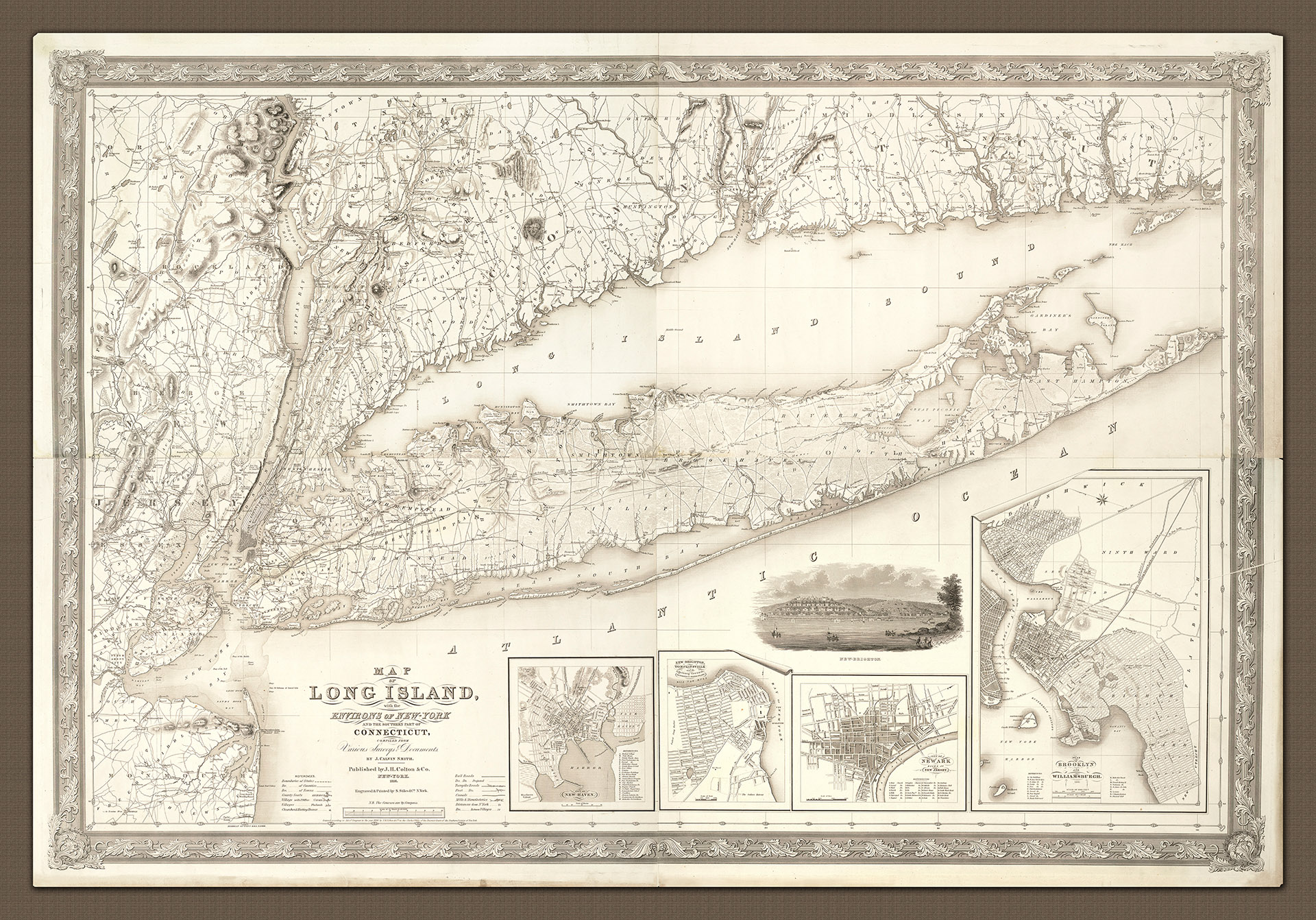
Joseph Hutchins Colton became renowned for his wide and elaborate decorative borders, and all of his prints were engraved using expensive steel plates rather than the more popular (and cheaper) wax engraving techniques. This particular chart was originally printed on four separate sheets.
At the time this chart was produced, Colton did not have an 'in-house' engraver and he relied upon purchasing the copyrights from other map-makers such as Stiles and co. The surveys for this edition were undertaken prior to 1836, judging from the detail provided of Manhattan, and it shares a great deal with later Colton publications through the stylistic mix of detail (including the development of the railways, roads and city/town planning), as well as the inclusion of land relief.
As a mark of the rapid development of the region Colton includes views of New-Brighton as well as plans of New Haven, New Brighton, Tompkinsville along with the adjoining areas of Richmond Co., Staten-Island, the city of Newark, Essex Co. New Jersey, Brooklyn and Williamsburgh. He also includes State, County and Town boundaries.
As if to highlight the changing times and the transition from an old Colonial world to a modern, urban, industrial and manufacturing world, Colton and Calvin Smith include features from both in the same map - villages with Post Offices, churches and meeting houses, turnpikes and post roads, native Indian settlements, windmills and telegraph stations, canals, railways (and projected lines). The map also includes the sites of Revolutionary War battles and even the location of the execution of Major Andre at Tappentown (Oct 2, 1780).
The inclusion of bathing houses and a hotel on Coney Island as well as the location of horse racing and trotting courses are clear indications of the rise of the leisure industry arising from new made wealth.
This 1836 map is an early and rare edition of J H Colton's 1844 map of the same name. It represents an important link in the chain of 'modern' American map making in the 19th century. Not only was it surveyed, engraved and published by the foremost American map makers in the business at the time, but it is also a rarely seen edition of what later became a well-known and important map of the region. Later editions included updated information such as extensions to the railways.