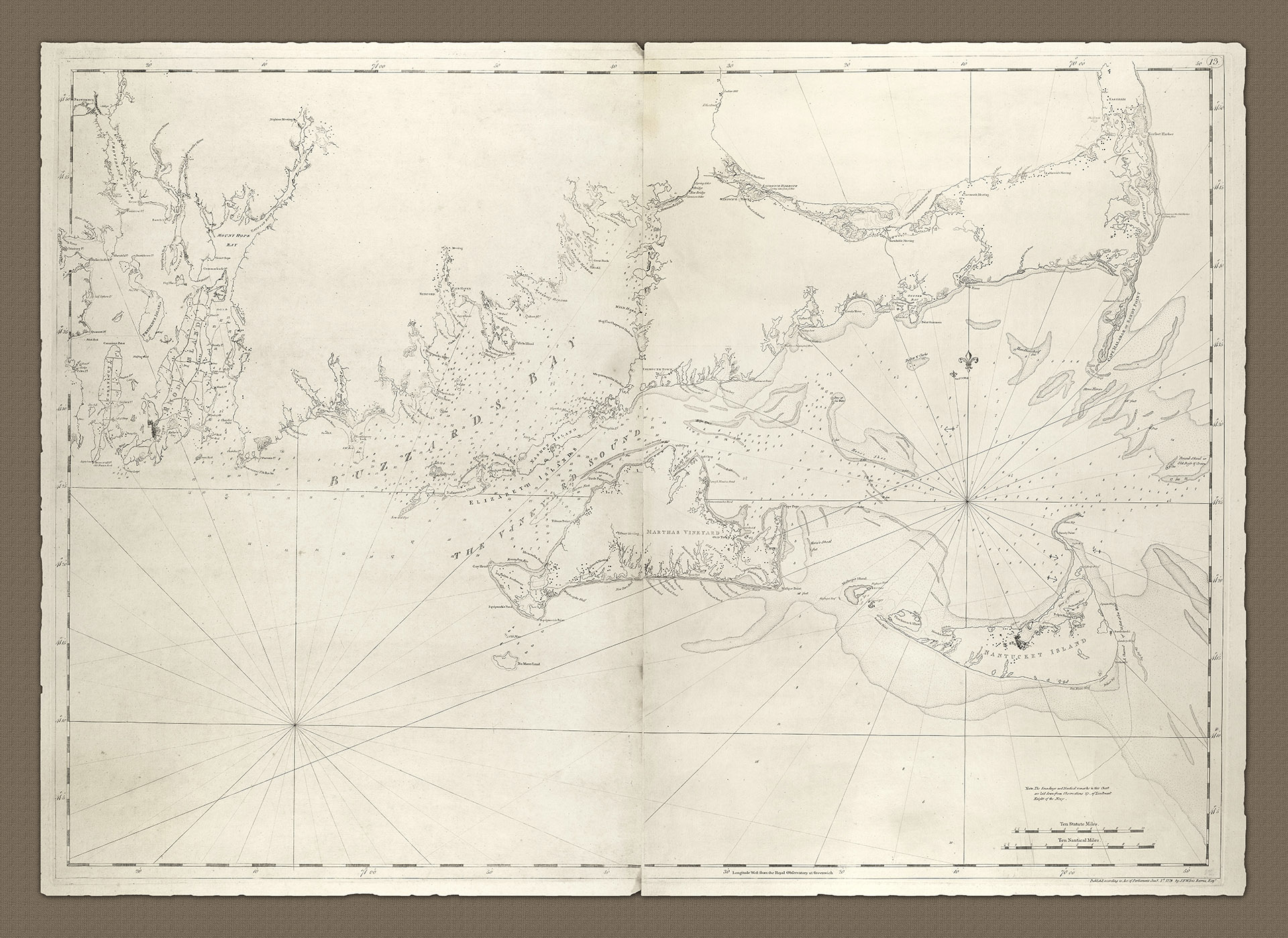
A115 - New England from Chatham Harbour to Narragansett Bay showing Buzzards Bay
A clear and concise chart of one of the most important sailing areas on the NE coast of America, between New York and Boston around Rhode Island, the islands of Martha's Vineyard and Nantucket, south of Cape Cod.
- 1779
J.F.W. Des Barres
- h35" x w48"
- L
This is undoubtedly a later version of this chart which the Library of Congress lists as a 6th state edition, with the number 13 engraved in a small oval in the upper right corner. The chart relies on the soundings and nautical Remarks of Lt. John Knight, a hydrographer who contributed a great deal to surveys of this region (see also Heritage Charts A101 and A113).
This version of the chart includes a good deal of hydrographic information with soundings in Narragansett Bay, Buzzards Bay, Vineyard Sound and in the stretch between Cape Cod and Nantucket Island. Shoals, banks, anchorages and reefs are detailed and includes a channel for shallow water craft at the east end of Nantucket Island. It also shows towns, houses, roads, meeting houses, churches, and a surprising number of wind-mills. Included, of particular interest, is the Native Indian settlement on the western point of Martha's Vineyard.
The section of the chart covering Narragansett Bay bears a remarkable resemblance to Heritage Chart A105 - the names used, and the placement of the names are almost identical, as are other geographic and economic features. It is quite likely that this section of the chart was copied from the outline and detail of the earlier chart. More up to date and relevant detail, including soundings through the east channel of Rhode Island through to Mount Hope Bay was then added.
At a time when the conflict in the War of Independence was at its peak there was a veritable thirst for information back in Britain, and Des Barres was doing all he could to quench that thirst for knowledge and news as quickly as he could. He would undoubtedly have made use of whatever information he had at his disposal, and this would have included existing surveys (complete or not) made by the teams of surveyors, map-makers and hydrographers working up and down the North American Atlantic coast at the time.
- New England from Chatham Harbour to Narragansett Bay showing Buzzards Bay