The chart covers; New York, North River, East River with passage through Hell Gate, Flushing Bay, Hampstead Bay, Oyster Bay, Huntington Bay, Cow Harbour, East Chester Inlet, Rochelle, Rye, Patrick Islands, & beyond. Passage through the treacherous upper passage of the East River and safe anchorage was paramount to control or the region.
The fact that the original Des Barres publication appears to have been left unfinished is indicative of the pressure Des Barres and other hydrographers and surveyors were under from the Army and in particular the Navy to produce up to date information.
It is worth noting the label 'Frog Point', also known as 'Throg's neck', was the point on 12th October 1776 where Admiral Lord Howe, having already navigated 150 vessels through the treacherous 'Hell's Gate' in a display of masterful navigation, chose to disembark 4,000 troops under General Henry Clinton, in an effort to out-flank Washington in his retreat from New York. It proved to be nearly fatal as the point of land proved to be little more than an island connected to the mainland only at low tide. A small detachment of American riflemen held the British up for 4 days and eventually forced Howe to re-embark and move further up river to Pell's Point (see Heritage Chart A204). The episode alerted the American commander-in-chief, George Washington, who wrote at the time that the British were up to 'their former scheme of getting to our rear', and accordingly moved to abandon his Harlem Heights bastion and move on up towards White Plains.
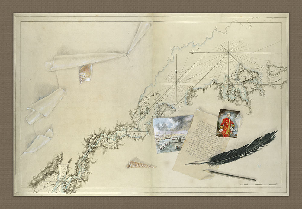
This chart of New York and the East river into Long Island Sound was produced by J.F.W. Des Barres in 1776 at the outbreak of the Revolutionary War to help ensure safe passage for the British fleet under Lord Richard Howe through the East River to Long Island Sound. The print you see here has been embellished by British artist Tessa Land-Smith, who loved the simplicity of the Des Barres print but wanted to make use of the space on the sheet. The overall effect is quite stunning.