top of page
Catalogue
North American Collection
World Collection
About
Surveyors & Chart Makers
Research Locker
Logbook
Contact Us
More
Use tab to navigate through the menu items.
Sort by
Load Previous
ME802b - The Arabian coastline from Qatar to the UAE. Western sheet
ME802c - The Arabian coastline. Central sheet
ME802d - The Arabian coastline. Eastern sheet
ME807 - Arabian Coast showing Harbours attacked by the British
ME808 - A Survey of Part of the Gulf of Persia
ME812 - The Gulf of Persia
ME816 - A Chart of the Persian Gulf
ME821 - A Survey of the Persian Gulf
ME825 - A Chart of the Gulf of Persia
NZ100N - A Chart of Part of New Zealand (North Island)
NZ100S - A Chart of Part of New Zealand (South Island)
NZ101 - Original Chart of New Zealand by the Master of H.M.S. Endeavour
NZ102 - A Chart of New Zealand explored by Captain James Cook in 1769 &c 1770
NZ103 - A Chart of Poverty Bay, New Zealand
NZ104 - East coast of North Island, New Zealand and Povery Bay
UK100 - Falmouth & Carreg Road with Helford Sound
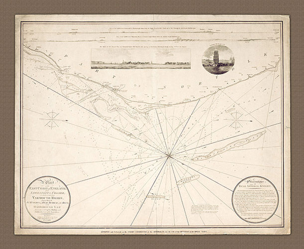
UK101 - Norfolk Coast, Lowestoff to Cromer
UK106 - An Actual Survey of the County of Sussex
W100 - Novissima Totius Terrarum Orbis Tabula
Z100 - The Island of Zanzibar
WORLD COLLECTION
Catalogue
North American Collection
World Collection
About
Surveyors & Chart Makers
Research Locker
Logbook
Contact Us
bottom of page